 | Object number: X9861
Gallery: Maps and Plans
Object Name: map
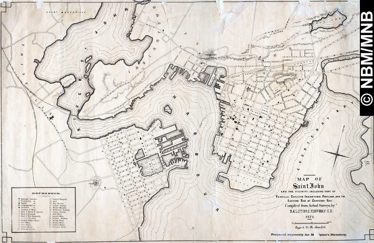
Title: Map of Saint John & The Vicinity Including Part Of Fairville, Carleton, Indiantown, Portland & The Eastern Of Courtenay Bay
Artist: Balston C. Kenway
Date: 1872
Medium: lithograph on paper
Dimensions: overall: 67 x 100.5 cm
Credit Line: New Brunswick Museum Collection
|
|