 | Object number: 19747
Gallery: Maps and Plans
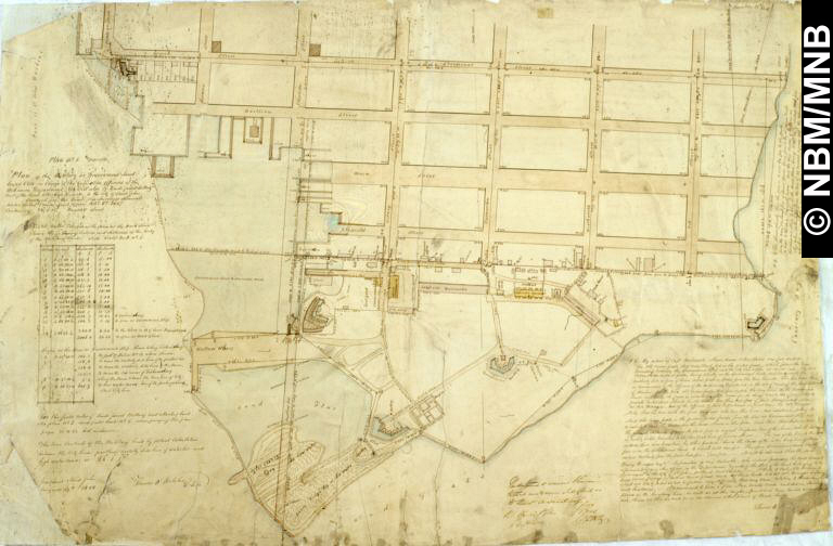
Object Name: plan
Title: Plan of Military or Government Land, Lower Cove, Saint John, N.B.
Artist: Thomas O'Keleher
Date: 1848
Medium: ink and watercolour on paper
Dimensions: overall: 65.7 x 97 cm
Credit Line: New Brunswick Museum Collection
|
|