| |
| Page: 1 | 2 | 3 | 4 | 5 | 6 | 7 | 8 | 9 | 10 | 11 | 12 | 13 | 14 | 15 | 16 | 17 | 18 | 19 | 20 | 21 | 22 | 23 | 24 | 25 | 26 | 27 | 28 | 29 | 30 | 31 | 32 | 33 | 34 | 35 | 36 | 37 | 38 | 39 | 40 | 41 | 42 | 43 | 44 | 45 | 46 | 47 | 48 | 49 | 50 | 51 | 52 | 53 | 54 | 55 | 56 | 57 | 58 | 59 | 60 | 61 | 62 | 63 | 64 | 65 | 66 | 67 | 68 | 69 | 70 | 71 | 72 | 73 | 74 | 75 | 76 | 77 | 78 | 79 | 80 |
| |
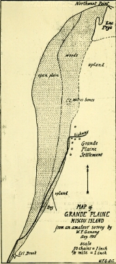 | William Francis Ganong
Map of Grande Plaine Miscou Island from an Amateur Survey by W. F. Ganong - August 1905
paper
15.0 x 6.5 cm, scale: 5/8 inch = 1 mile
William Francis Ganong Fonds (S224 F446 5)
© New Brunswick Museum
| | |
|
 | William Francis Ganong
Map of Portion of Little Southwest Miramichi to Illustrate its Physiography
paper
5.5 x 20.0 cm
William Francis Ganong Fonds (S224 F446 6)
© New Brunswick Museum
| | |
|
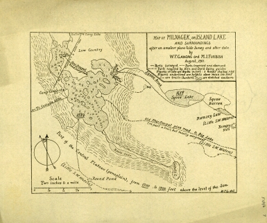 | William Francis Ganong
Map of Milnagek, or Island Lake and Surroundings after an Amatuer Plane-Table Survey and Other Data by W. F. Ganong and M.I. Furbish - August 1901
paper
14.5 x 18.0, scale: 2 inches = 1 mile
William Francis Ganong Fonds (S224 F446 7)
© New Brunswick Museum
| | |
|
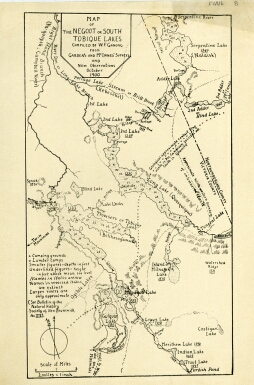 | William Francis Ganong
Map of the Negoot or South Tobique Lakes, compiled by W.F. Ganong from Garden's and McInnes' Surveys and New Observations - October 1900
paper
22.4 x 12.7 cm, scale: 1 inch = 2 miles
William Francis Ganong Fonds (S224 F446 8)
© New Brunswick Museum
| | |
|
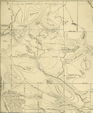 | William Francis Ganong
Map of the Walkemik or Upper North Branch of the Little Southwest Miramichi complied by W. F. Ganong from Timber-Line Surveys, a Sketch Map by Henry Braithwaite, and Amateur Surveys by W. F. Ganong and A. H. Pierce - July/August 1904
paper
16.5 x 22.7, scale: 1 inch = 1 mile
William Francis Ganong Fonds (S224 F446 9)
© New Brunswick Museum
| | |
|
 | William Francis Ganong
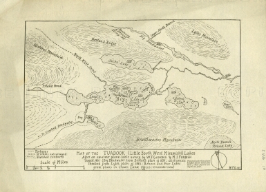
Map of the Tuadook ( Little Southwest Miramichi Lake ) after an Amateur Plane-Table Survey and Other Data by W. F. Ganong and M.I. Furbish - August 1901
paper
16.5 x 24 cm, scale: 1.25 inches = 1 mile
William Francis Ganong Fonds (S224 F446 10)
© New Brunswick Museum
| | |
|
 | William Francis Ganong
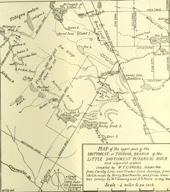
Map of the Upper Part of the Southwest, or Tuadook Branch of the Little Southwest Miramichi River and Adjacent Waters - October 1904
paper
17.4 x 15.4 cm, scale: 1 inch = 2 miles
William Francis Ganong Fonds (S224 F446 11)
© New Brunswick Museum
| | |
|
 | William Francis Ganong
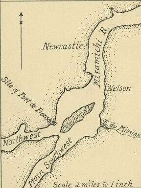
Map Showing Miramichi River at Beaubears Island
paper
11.6 x 8.6 cm, scale: 1 inch = 2 miles
William Francis Ganong Fonds (S224 F446 12)
© New Brunswick Museum
| | |
|
 | William Francis Ganong
sketch: View along Nictor Lake showing Visitor's Island & Moraine Island
paper
9.0 x 26.2 cm
William Francis Ganong Fonds (S224 F448)
© New Brunswick Museum
| | |
|
 | William Francis Ganong
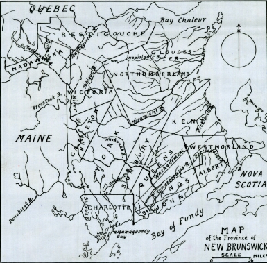
Map of the Province of New Brunswick
paper
18.0 x 18.0 cm, scale: 1 inch = 36 miles
William Francis Ganong Fonds (S224 F448 1)
© New Brunswick Museum
| | |
|